


At the beginning, let’s compare the hex map to the classical filled map with real country borders
+ the size of the countries doesn’t influence our first impression of the data, no bias
+ therefore perfect for any data that is calculated per capita
+ it satisfies the human need for objects with continuing geometric orders
+ it’s a matter of taste, but some would say it looks pretty cool
- it calls itself a map but it is not representative in terms of size and therefore not usable for any data based on the actual size of the ground
- although there seems to be some conventions on how to draw a hex map for the U.S., it is not clearly defined by its real shape and another person could build the hex map in another way
- the great number of states in the U.S. and its characteristic shape make it well usable for the U.S. but for other countries it could be much more difficult
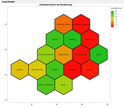
The last Con is now to be compared with Germany. I could find only one hex map for Germany which can be copied freely and is therefore shown here
Version A
So the biggest problem is already visible at first sight. This does NOT resemble Germany! Maybe I would buy it if one would say it is Austria, but never Germany. I like this example though because for this data (foreigners per capita) the geographical size doesn’t matter. Hamburg, Bremen or Berlin would be super small in a filled map but the inhabitants per m² are so high in these states that they should get more attention as they would get in a filled map. On the other hand we also have the advantage of the geographical proximity. Obviously the message of this map is the lower percentage of foreigners in the eastern states but with the hexmap we are not biased by the size in m².
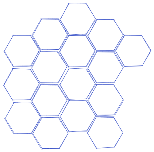
As I’m unhappy with the shape of the hexmap I found I sketched two versions with Excalidraw by myself. One with the hexagon’s flat on the bottom and the other with the edge on the bottom.
Version B
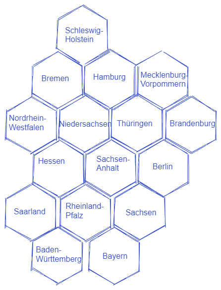
Version C
For me I defined three characteristics in terms of the shape of Germany. Firstly, only Bayern and Baden-Württemberg should be in the south. Version A and C are doing this very well, in B they are not connected. Secondly, Schleswig-Holstein should be clearly in the north. This is maybe the most characteristic part and here only Version C is satisfying me. Thirdly, the whole shape should be visibly longer from north to south than from east to west. Again, it is only Version C, which delivers a good result and so I would suggest to make it the official hexmap of Germany 😊.