


With a spatial match, you can create a relationship between two geographical objects. An example of this would be finding points in London city, such as bus stops, that are inside specific London boroughs to then use that for further analysis.

The Spatial Match Tool
The tool has 4 anchors in total: 2 input anchors and 2 output anchors. The input anchors consist of a target anchor (T) and an universe anchor (U), whilst the output anchor consists of a matched anchor (M) and an unmatched anchor (U).
The spatial object put into the target anchor (T) is the data that is trying to be matched to the data in the universe anchor (U). For each value in the target anchor, the spatial match tool looks through all of its' spatial objects and attempts to find a match in the data in the universe anchor (U).
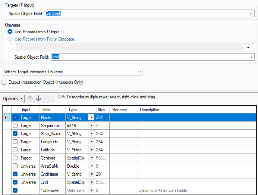
The configuration section of the tool is very simple and intuitive to use. There is the chosen field for the Target input (T) and the Universe input (U). It is also good to know that instead of bringing data from an input, the Universe input (U) can be brought in directly from a file on your PC!
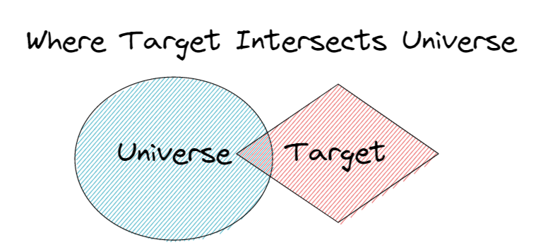
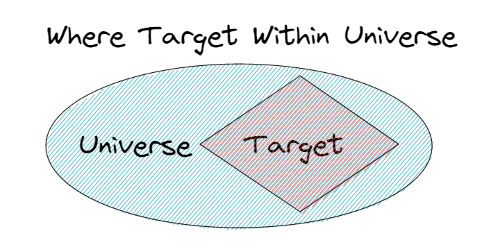
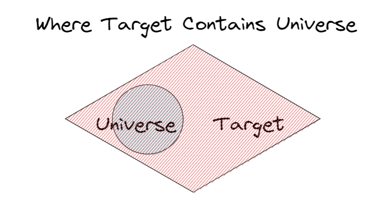
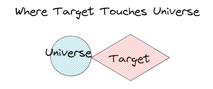
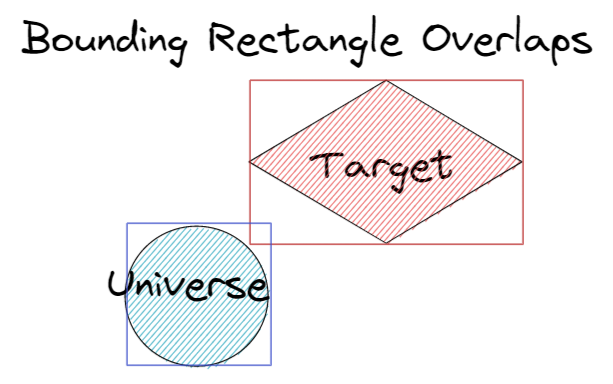
Once you've configured your inputs and outputs, you can now choose one out of 7 types of matching. There is:
There is also an option called 'Output intersection object (intersects only)' that you can tick if you want the intersection polygon to be included in downstream tools.
After, you may change the order, names, and data types, and data sizes of all fields much like a join tool to complete your use of the Spatial Match tool. This is a very helpful tool in building a meaningful, geographical dataset.
To understand the behaviors between different spatial objects when being spatially matched within the tool, visit the Alteryx help page: https://help.alteryx.com/20221/designer/spatial-match-behavior