


When working with location-based data, the first step is to get your data into a spatial format that Alteryx can understand and manipulate. In this blog, we’ll walk through how to import datasets with latitude and longitude coordinates, convert them into spatial points, and explore basic spatial objects and tools in Alteryx.
Why Use Spatial Data?
Spatial data lets you perform powerful geographic analysis, such as finding distances, nearest neighbors, clustering, and mapping. Whether you're planning a golf tour, optimizing delivery routes, or analyzing site locations, understanding how to work with spatial objects is key.
Step 1: Input Your Data
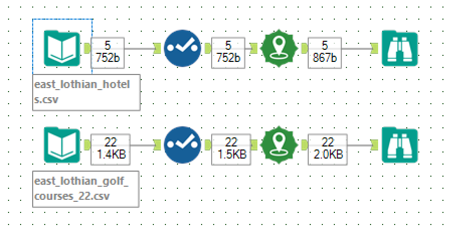
Start by bringing your datasets into Alteryx. For this example, we’ll use two CSV files:
- East Lothian Golf Courses — with columns for course name, latitude, longitude, and address.
- Hotels in East Lothian — similarly structured with name, address, latitude, and longitude.
Use the Input Data Tool to load each file into your workflow. Find the data at the bottom of this blog.
Step 2: Check Your Latitude and Longitude Data Types
Before creating spatial points, it's important to make sure your latitude and longitude fields are of the correct data type:
- Use the Select Tool to verify and, if needed, change the data types of your latitude and longitude columns to Double. Always required if you're using CSVs.
Step 3: Create Spatial Points Using the Create Points Tool
The next step is to convert your latitude and longitude columns into spatial points:
- Add the Create Points Tool to your workflow.
- Map your latitude and longitude fields to the respective inputs in the tool.
- The tool outputs a new spatial object field that represents each location as a point on a map.
This spatial object is how Alteryx recognizes locations for any geographic operation.
Step 4: Explore Your Spatial Data with the Browse Tool
To visualize and inspect your spatial points, connect a Browse Tool to the output of the Create Points Tool:
- The Browse Tool allows you to see your spatial data on an interactive map within Alteryx.
- You can pan, zoom, and click on points to inspect their attributes.
- This step helps validate that your data looks correct spatially before continuing.
Understanding Spatial Objects in Alteryx
Alteryx spatial objects come in several types:
- Points: Single geographic locations (latitude/longitude pairs).
- Lines: Sequences of connected points (e.g., routes).
- Polygons: Closed shapes representing areas (e.g., city boundaries).
- Multipoints: Groups of points treated as a single object.
When you use the Create Points Tool, you’re working with point objects, the foundation for most spatial analysis.
Next Up: In Part 2, we’ll explore how to use spatial tools to calculate distances and find the nearest hotel to each golf course.