


Introduction
In this blog, we move beyond points and distances to work with areas — specifically, zones around golf courses and hotels. Our goal is to find regions that are close to golf courses but not close to any hotels, revealing potential gaps in accommodation coverage.
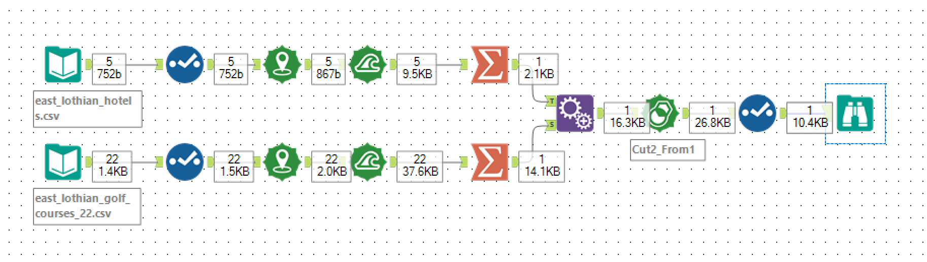
Step 1: Create Buffers Around Golf Courses and Hotels
- Use the Buffer Tool twice:
- One buffer for golf courses (e.g. 2 miles radius) — this shows playable areas around courses.
- Another buffer for hotels (e.g., 5 miles radius) — showing hotel coverage zones.
Each tool outputs multiple polygons (one per record).
Step 2: Combine Buffers Within Each Dataset Using Summarize Tool
- Since buffers are individual polygons, use the Summarize Tool with the Spatial Combine option to combine all golf course buffers into a single polygon.
- Repeat for hotel buffers to get a single combined hotel coverage polygon.
- Rename these fields: "Hotel Buffer" and "Golf Course Buffer"
Step 3: Prepare Data for Spatial Difference
- To find areas close to golf courses but not close to hotels, we need to calculate the spatial difference between these two combined polygons.
- However, the Spatial Process Tool requires both polygons in a single input dataset with a field distinguishing them.
- Therefore, append the fields to give us 2 fields, each containing a single polygon.
Step 5: Use the Spatial Process Tool to Find Difference
- Add a Spatial Process Tool to your workflow.
- Configure the tool so it subtracts the hotel polygon from golf course polygon.
- This outputs polygons representing areas within golf course buffers excluding hotel buffers.
Summary
Using buffer, summarize, union, and spatial process tools together, you can:
- Define coverage zones around points of interest.
- Combine multiple coverage areas into one.
- Find gaps where one coverage exists without the other.
This approach gives powerful insight into spatial relationships beyond simple point distances — critical for planning a golf tour or improving service accessibility.
Next Steps
If you enjoyed this 4 part blog, consider experimenting with:
- Use the Trade Area Tool to create drive-time or walk-time zones for realistic accessibility analysis.
- Calculate area and perimeter of polygons with the Spatial Info Tool for spatial metrics.