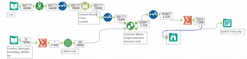
In a recent Alteryx lesson we learnt about creating a shape file with the location names attached. In this specific workflow I am using the Match tool to combine a shape file to location data in the .csv file.
When selecting the Grid tool there is the option to choose the grid size in either Miles or Kilometers. There is also the option to generate single grid for entire layer or generate grids for each object with a sub-select to clip to polygons.
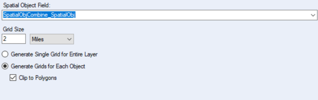
In the Spatial Object Field select the column that contains the spatial object.
There are a couple options to consider when deciding what the combination of the grid and spatial object selection will look like when using the Summarize tool.
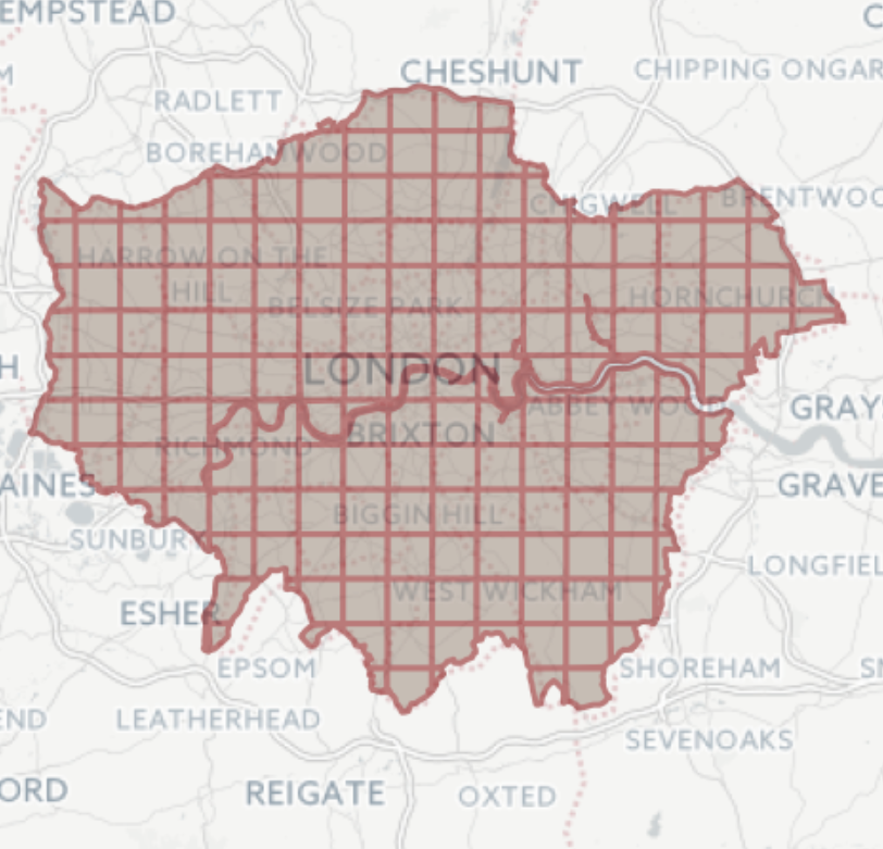
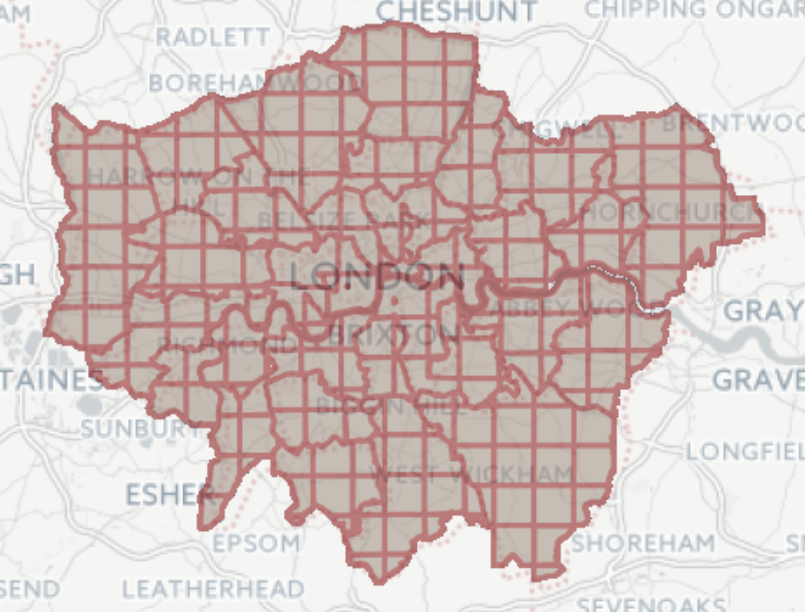
Using the Summarize tool to combine spatial objects using the spatial object combine function and selecting the option to clip to polygons shows as one spatial object with the normally box shaped grid cut off to the outermost boundaries of the shape. This happens because the Summarize tool combines all the individual shape files into one.
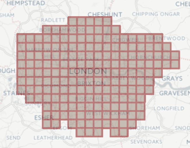
Using the Summarize tool to combine spatial objects using the spatial object combine function and not selecting the option to clip to polygons shows as one spatial object but the grid has not been clipped. The shape of London shows but the grids on the boundary remain as boxes and therefore not in the exact shape of London.
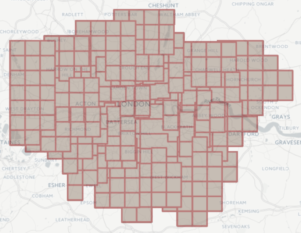
Not using the Summarize tool to combine spatial objects and selecting the option to clip to polygons shows as the individual London borough but with their grids cut off so that the shape of each borough is kept and the boundaries are clearly defined.
Not using the Summarize tool to combine spatial objects and not selecting the option to clip to polygons shows as the London boroughs as individual grids that overlap each other. This doesn’t look great and I don’t think there’s a good use case scenario for this view.